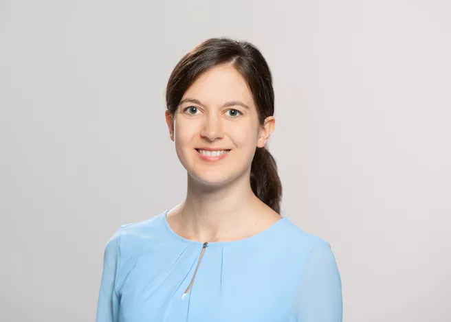
Katharina Anders (*1990) studied Geography with Computer Science and Environmental Physics at Heidelberg University. She graduated with a doctorate in geoinformatics (with distinction) at the Institute of Geography and Interdisciplinary Centre for Scientific Computing at Heidelberg University with a research stay at Delft University of Technology. In 2023, she was appointed Professor of Remote Sensing Applications at TUM.
She researches the analysis of remote sensing data in order to gain information and scientific knowledge about processes on the Earth's surface. Her focus is on the cross-scale observation of topographic landscape dynamics in the context of natural hazards, climate change impacts, and human-environment interaction. An important goal is the operationalization of automatic 4D observation (3D space and time) for various geo- and environmental monitoring applications.
ED: How did you get to be who you are?
Katharina Anders: When I was at school, I chose geography as my main subject - more by accident than anything else - because I couldn't do history or Latin. How is the Earth's surface formed? What processes shape our landscapes? I was particularly fascinated by the geomorphology of the high mountains, and my interest in geography led me to study it. On the methodological side, I specialized in geoinformatics: How can we collect geodata that describe the Earth's surface as accurately as possible? What automatic methods, such as artificial intelligence, can be used to analyze this data? As a geographer, I came into the area of geodesy to apply these methods for monitoring natural hazards or measuring the effects of climate change, for example. The following career steps were a Master's degree, a doctorate, a postdoc at Heidelberg University - and the call for applications at the TUM for this tenure-track professorship in remote sensing applications, which extraordinarily appealed to me.
What interested you most about the topic?
Of course, I was very interested in geomorphology, the shaping of the Earth's surface, the glaciers, the deserts, and the river landscapes. It was the best class I ever had. Then, I find the methodology fascinating, like laser scanning. We can capture, describe, and measure 3D data of these landscapes and derive models.
What will be your first research project at TUM?
The German Research Foundation (DFG) has just approved a project proposal I wrote in Heidelberg that we realize in cooperation with Heidelberg University. The goal is to automatically analyze 4D point clouds, e.g., a time series of three-dimensional data, using a method we developed. During my research stay at the TU Delft, we started this by processing thousands of point clouds collected from a sandy beach on the Dutch coast every hour for months using laser scanning.
These dense time series accurately describe processes over time, such as wind transporting sand on a beach on small scales that we could not previously measure spatially. Spatio-temporal 4D data now make this possible. And methods are needed to analyze these data automatically. The goal is to make this information and models available to decision-makers, for example, to analyze measures. Does it make sense to build a dike or add sand? And how are natural processes influenced again by this?
In addition to sandy beaches, this method can also be applied to alpine slopes or snow cover, and my goal is to further automate the data analysis and make it generalizable so that many people can use it. Another exciting aspect I am pursuing is how we can combine these spatiotemporally detailed data with larger-scale and less frequent observations, such as satellite images. In this way, we may eventually be able to trace Earth-shaping processes across scales.
Do you have a particular approach to science education?
On the research front, we train people for the job market, but also young academics. I always try to make clear what we are actually working on. In teaching, it's essential for me to get people excited about research and to give them a broad picture of the subject. Of course, it is important to learn the theory, but I also want to go out with the students, collect data, and let them analyze it themselves. I hope to get many young people interested in our field.
What changes would you like to see in the future?
Open science in research is fundamental to me. For me, progress means publishing data in the methodological work of geography as soon as possible so that other scientists can use it. Software, i.e., the methods we develop, should also be available so that many people can use them. This includes a culture of error, but that's how we move forward.
Personally, I hope that the balance between family and academic career will continue to change for the better. That was an issue when I was thinking about starting a doctorate. Can I do it, or will I be out at some point? Now, I have a six-month-old daughter, and it feels more manageable and normal than I thought. I've had a good experience here at TUM and am well-supported. I recently became the deputy women's representative at the TUM School of Engineering and Design. This is something I would like to get involved with in the future.
Link to the Professorship for Remote Sensing Applications
